Payette Land Trust
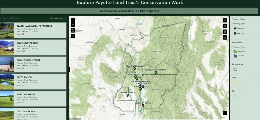
This project dashboard is an example of how incredibly dynamic Experience Builder applications can be. The application allows Land Trust staff to view their own assets and images alongside authoritative reference data from other agencies and stakeholders. It also incorporates information to help them streamline and prioritize their workflows.
The Challenge
The Payette Land Trust needed an efficient way to manage conservation assets, communicate with the community about their efforts, and make data-driven decisions about future land acquisitions within their four-county service area.
The Solution
We created an Experience Builder application that serves as both a public communication tool and an internal asset management system, streamlining operations while enhancing community engagement.
Key Features
Public Communication Dashboard
- Service Area Boundaries – Clear visualization of conservation regions
- Conservation Easements – Interactive mapping of protected properties
- Land Trust Properties – Display of fee title holdings
- Community Engagement – Public access to conservation impact data
Internal Management Tools
The application provides dynamic workflow management with an intuitive interface:
- Layer list management and advanced filtering
- Real-time data editing and markup tools
- Buffer analysis and property query capabilities
- Data import and drawing functionality
Results & Impact
Operational Benefits
- Streamlined workflows with real-time data access and updates
- Improved decision-making through data-driven property evaluation
- Enhanced collaboration among staff and board members
- Reduced administrative time through automated processes
Stakeholder Engagement
- Public transparency in conservation achievements
- Professional presentations for donor and grant application
- Community education through interactive mapping
- Clear impact demonstration for funding and support
Technology Platform
- ArcGIS Experience Builder – Modern, user-friendly application development
- Cloud-based architecture – Accessible from any device with internet
- Mobile-responsive design – Full functionality on desktop, tablet, or mobile
- Multi-source integration – Combines various data sources seamlessly
Key Takeaways
The Payette Land Trust application shows how Location3x creates solutions that serve both internal operations and public engagement needs. Whether managing conservation lands, public infrastructure, or community resources, our approach delivers measurable improvements in efficiency and stakeholder communication.
Contact Location3x (location3x_gis@gmail.com) to discuss how similar solutions can benefit your organization.