Real-Time Wildfire Monitoring System
Live Emergency Management Through Real-Time Data Analytics
Location3x developed a real-time wildfire monitoring application that provides emergency managers with up-to-the-minute intelligence for critical decision-making during wildfire events.
The Challenge
Emergency management agencies need immediate access to current wildfire data to make rapid decisions about resource deployment, evacuations, and public safety measures. Traditional reporting delays can compromise response effectiveness.
The Solution
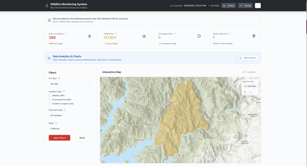
We created a comprehensive monitoring system that updates every 15 minutes with live data from IRWIN and NIFC, providing real-time situational awareness for emergency managers across multiple states.


Key Features
Real-Time Monitoring
- Live incident tracking with 15-minute data updates
- Current metrics including active fires, total acreage, and containment status
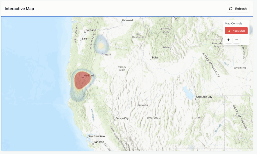
- Geographic visualization showing fire locations and affected regions
- Heat map analysis for identifying high-activity areas
Interactive Analysis Tools
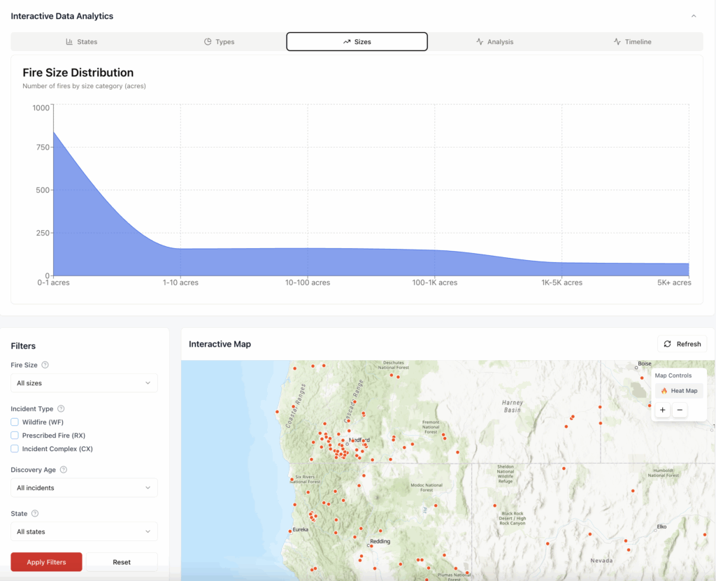
- Advanced filtering by fire size, incident type, discovery age, and state
- Zoom-to-fire capability with detailed perimeter mapping
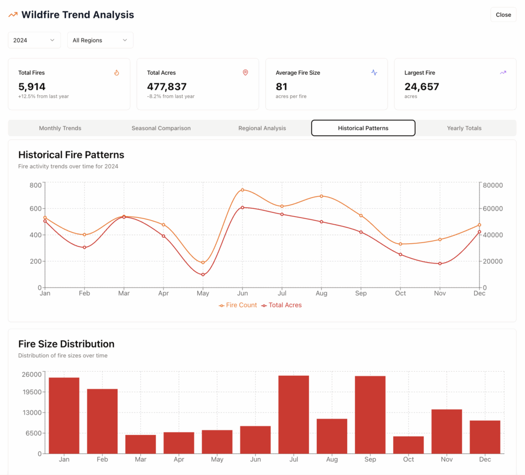
- Historical trend analysis showing seasonal and yearly patterns
- Fire size distribution charts and statistical breakdowns
Data Access & Export
- Real-time data export for external analysis and reporting
- Interactive charts for briefings and presentations
- Custom filtering for specific operational needs
- Dashboard screenshots for documentation and communication
Government Applications
This system demonstrates capabilities directly applicable to various government emergency management needs:
Emergency Operations – Real-time monitoring for incident command and resource allocation
Multi-Agency Coordination – Shared situational awareness across jurisdictions
Public Information – Reliable data for community updates and evacuation planning
Infrastructure Protection – Geographic analysis for critical asset security
Technical Performance
- Live data integration from authoritative government sources
- 15-minute update cycle ensuring current information
- Responsive design for desktop, tablet, and mobile access
- Fast performance optimized for emergency situations


Results
The application provides emergency managers with the real-time intelligence needed to make informed decisions quickly, improving response coordination and public safety outcomes through reliable, up-to-date wildfire information.
Contact location3x_gis@gmail.com to discuss how real-time monitoring applications can enhance your agency’s emergency management capabilities.